
Seawall repair in Vanderbilt Beach & Conners
Paying into a waterway district does not establish that the district maintains the canal beside your wall. Confirm that boundary before planning the work.
Describe your project on this page ↓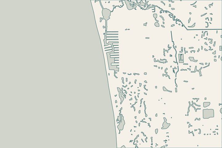
Get to know your waterfront
Vanderbilt Channel and Water Turkey Bay lie east of Delnor-Wiggins Pass State Park. The Cocohatchee estuary reaches the Gulf through Wiggins Pass. The Vanderbilt Waterway MSTU supports a defined channel-maintenance function, while individual canals and private structures need their own responsibility checks. This distinction matters when a wall proposal includes access dredging or debris removal.
Vanderbilt Waterway MSTU · March 2024 Vanderbilt Waterway meeting packet
Check maintenance responsibility before assuming coverage
The March 2024 MSTU packet records staff describing the maintained marked channel north from the Vanderbilt Channel bridge toward Wiggins Pass. It expressly places Vanderbilt Beach canals outside that responsibility. Staff also explained that the district’s taxable map does not identify its maintenance limits. Channel maintenance record Canal exclusion Tax and maintenance boundaries
Keep three questions separate
- Who maintains the channel? Request the current written limits rather than relying solely on the historic minutes.
- Who owns the wall and dock? Check the survey, title and association records where relevant.
- What work is authorized? Describe repair, demolition, dock changes and dredging individually in the permit inquiry.
Florida State Parks dates the channel’s initial dredging to 1950–1952 and identifies the estuary, including Water Turkey Bay, as Outstanding Florida Water since 1996. Those are reasons to identify the actual waterbody and habitat, not to assume a particular permit outcome. Estuary history
Ask the contractor to show how equipment reaches the property, including current clearance and water-depth assumptions. A boating route that suits a recreational vessel may not suit construction equipment.
What could the work cost?
Keep canal work, wall repair and dock alterations as identifiable line items. Ask who pays for a new survey, environmental review, equipment transfers and removal of any obstruction to the proposed access route.
Published contractor context, not a Naples average or a quote.
Compare quotes and plan a budget →Find the relevant permits and records
| Starting point | What to resolve | Prepare and look up |
|---|---|---|
Collier County Marine PRMAR | Route seawall, dock, boatlift or marine demolition work for the actual parcel. | Identify the folio and full scope; permit intake is (239) 252-2400. |
Vanderbilt Waterway MSTU | Confirm current public channel maintenance limits. | Use the canal name and map location; published staff contact is (239) 252-4980. |
A canal-responsibility check
Use the district records to ask better questions, then obtain current confirmation for the actual location.
Mark where the wall meets the canal
Give County staff the folio and an annotated aerial or survey. Ask about the canal itself as well as the wider marked navigation channel.
Request current maintenance limits
Ask whether the historic staff explanation still applies and which party handles the work you are considering. Keep the written response with the quote.
Match the application to the full job
Under Marine PRMAR, describe any seawall, dock, lift and demolition elements. Identify proposed dredging separately so it is not hidden in an access allowance.
Plan your Vanderbilt Beach project
Share the property address, the changes you have noticed and any photos or previous plans you have.
Clear options for your waterfront. A practical next step.
Vanderbilt Beach project questions
Does the MSTU maintain every Conners canal?
The reviewed historic packet says Vanderbilt Beach canals are outside its maintenance responsibility. Its taxable area is not a maintenance map. Ask staff to confirm the current boundary and who is responsible for the specific canal and work you have in mind.
Can an old channel depth establish today’s access?
No. The district minutes contain dated survey information, not a current clearance guarantee. Require the contractor to identify the survey date, tidal reference and actual vessel requirements used for its access plan. New observations may be needed before mobilization.
Keep planning
Nearby waterfront guides
Show sourcesHide sources
- Vanderbilt Waterway MSTUSource reviewed 2026-10-25
- March 2024 Vanderbilt Waterway meeting packetSource reviewed 2026-10-25
- Waterways and Wetlands at Delnor-WigginsSource reviewed 2026-10-25 · official indexed text
- Collier post-hurricane permit informationSource reviewed 2026-10-25 · official indexed text
- Collier Marine PRMAR application requirementsSource reviewed 2026-10-25