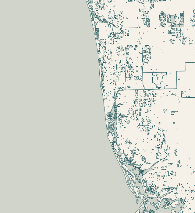
Choose the shoreline you know. Each guide explains the records, access and approval questions that make that area different.
Find your waterfront
Explore the coast. Find your starting point.
Explore Naples Bay, the northern bays and nearby Collier waterfront communities.
Full local guide
Choose a label to open local resources →Tap a community on the map or below ↗
Reference geography: U.S. Census Bureau, City of Naples GIS and Collier County GIS. October 2026 snapshot; orientation only, not a survey or navigation chart.
Your local starting point
Find your community.
Choose a guide for local maps, permit starting points and the records to gather for your property.
Port Royal and Aqualane Shores share a need to coordinate waterfront work with access and utilities, but their records are different. Port Royal has archived canal dredging and geotechnical files. Aqualane Shores has a documented gas and fiber extension project. Identify the exact parcel and canal before treating either record as information about your wall.
The East Naples Bay district covers canals in Golden Shores, Oyster Bay and Royal Harbor, from both sides of Curlew Avenue south. The City expressly excludes properties facing Naples Bay. The district dates to 1987 and addresses water quality, navigability and maintenance dredging. Those responsibilities should not be confused with a promise to repair a private seawall.
The City describes Moorings Bay as an urban estuary shaped by extensive alteration. Doctors Pass is its only direct inlet to the Gulf; culverts connect the north end toward Clam Pass. Waterfront properties from Seagate Drive to Banyan Boulevard fall within the Moorings Bay district, including Coquina Sands, the Moorings and Park Shore.
Park Shore has an unusually useful public record trail. The City commissioned seawall design at Venetian Bay Outlots A and B, while a separate settlement exhibit describes specific walls and access rights along Gulf Shore Boulevard North. These documents concern identified locations. They do not make every Park Shore wall a City asset or settle responsibility for an individual parcel.
Vanderbilt Channel and Water Turkey Bay lie east of Delnor-Wiggins Pass State Park. The Cocohatchee estuary reaches the Gulf through Wiggins Pass. The Vanderbilt Waterway MSTU supports a defined channel-maintenance function, while individual canals and private structures need their own responsibility checks. This distinction matters when a wall proposal includes access dredging or debris removal.
Pelican Bay Services Division has public water-management and preserve responsibilities, including work associated with Clam Pass and mangrove health. It publishes monitoring reports, management documents and permit records. These are useful context for a property discussion, but they do not establish permission to alter a private or association shoreline or work inside a preserve.
Haldeman Creek has a County maintenance-dredging advisory committee that recommends work programs and budgets. Nearby Danford Street has its own documented road and drainage work, with Bayview Park access considered in the project notice. For Bayshore and East Naples properties, identify which waterway, drain and access route actually touches your parcel before assigning responsibility.
Naples Bay reaches the Gulf through Gordon Pass, while the Golden Gate Canal discharges into the Gordon River and bay system. The City monitors river and bay water quality monthly. On the Gulf side, beach-end projects and the Coastal Construction Control Line create a different record trail. A nearby public project is useful context, not an assessment of your wall.
Isles of Capri and Goodland belong in a broader south Collier planning conversation, but they should not be treated as one shoreline. The County has documented navigation concerns near Isles of Capri and reviewed individual Goodland dock proposals on Blue Hill Creek. Begin with the parcel’s jurisdiction, ownership and existing shoreline treatment; then identify which County, state and federal questions apply.