
Seawall repair in Port Royal & Aqualane Shores
A sound repair plan starts below the cap: the canal bottom, hidden anchors and utilities can shape the work as much as the visible damage.
Describe your project on this page ↓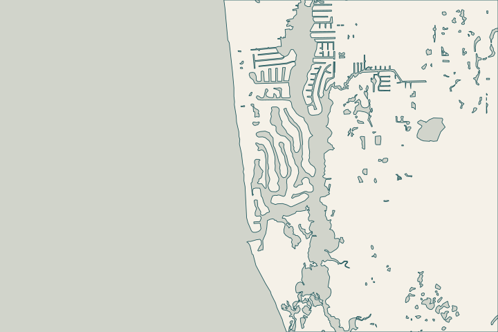
Get to know your waterfront
Port Royal and Aqualane Shores share a need to coordinate waterfront work with access and utilities, but their records are different. Port Royal has archived canal dredging and geotechnical files. Aqualane Shores has a documented gas and fiber extension project. Identify the exact parcel and canal before treating either record as information about your wall.
Special assessments · 2013 Port Royal canal dredging and habitat island solicitation
Bring the canal and utility records together
The City’s Port Royal archive names Galleon Cove, Harbor Head, Cutlass Cove, Doubloon Bay and Champney sampling locations. Its 2012 jet-probe table records different refusal conditions between sample points. That variation is a reason to ask what investigation your designer needs, not to choose a foundation from an old neighboring result. Port Royal survey archive Historical substrate observations
Three records worth separating
- The City lists a Port Royal dredging assessment with 2011 resolutions.
- A cancelled 2013 solicitation separated private dredging from its public canal scope; the City permit did not authorize private dredging.
- Aqualane Shores’ 2019 assessment concerned gas and fiber extension, while a 2023 scope studied possible electric, telephone and cable undergrounding.
These are different projects and dates. They do not prove that work is active today. Ask for the final records and current utility locations. Assessment records Private dredging distinction Utility feasibility scope
During assessment, show the proposed equipment route, pool or patio edges, neighboring returns and dock connections. Ask the designer to explain which observed defect each proposed repair addresses. A new cap, soil treatment and a replacement wall solve different problems.
What could the work cost?
Request separate amounts for investigation, access, utility protection, dock changes and landscape restoration. Keep any dredging price outside the wall allowance until its design and permit scope are clear.
Published contractor context, not a Naples average or a quote.
Compare quotes and plan a budget →Find the relevant permits and records
| Starting point | What to resolve | Prepare and look up |
|---|---|---|
City of Naples Building | Confirm the parcel, marine work and required plan set. | Bring the address, survey and photos. Published permit help: (239) 213-5020. |
City project and utility records | Identify the relevant canal file and current utility information. | Name the canal and folio; distinguish completed records from a feasibility study. |
A property file for the west bay waterfront
Build a small record set that contractors can price consistently. Mark the date of each survey and leave unresolved items visible.
Match the canal to the archive
Request the relevant Port Royal canal sheet and survey date. For Aqualane Shores, identify any earlier wall permit and utility-extension records tied to the parcel.
Port Royal Canal Dredging geotechnical report · Special assessments
Locate the excavation conflicts
Ask the designer and utilities which services cross the proposed anchors or equipment path. The undergrounding study is a starting question, not a map of installed services.
Aqualane Shores/Royal Harbor/Port Royal utility undergrounding feasibility scope
Separate wall and dredging decisions
If access or boat depth prompts dredging, obtain its own scope and authorization review. Keep the evidence supporting wall repair separate from the desired navigation outcome.
2013 Port Royal canal dredging and habitat island solicitation
Plan your Port Royal & Aqualane Shores project
Share the property address, the changes you have noticed and any photos or previous plans you have.
Clear options for your waterfront. A practical next step.
Port Royal & Aqualane Shores project questions
Can the old Port Royal survey replace a new investigation?
The archived probes describe particular points in 2012. They cannot establish today’s water depth, wall condition or the ground behind your property. Give the archive to your designer and ask what current measurements are needed before a repair method is selected.
Does a City dredging project include my private waterfront?
Do not assume so. The archived 2013 solicitation distinguished private dredging and required its own regulatory permits. Confirm the actual public project limits and your parcel’s current permissions; a historical assessment or bid title is not authorization for new work.
2013 Port Royal canal dredging and habitat island solicitation
Keep planning
Nearby waterfront guides
Show sourcesHide sources
- Special assessmentsSource reviewed 2026-10-25 · official indexed text
- 2013 Port Royal canal dredging and habitat island solicitationSource reviewed 2026-10-25
- Port Royal Canal Dredging geotechnical reportSource reviewed 2026-10-25 · official indexed text
- Aqualane Shores/Royal Harbor/Port Royal utility undergrounding feasibility scopeSource reviewed 2026-10-25 · official indexed text
- City electronic permit helpSource reviewed 2026-10-25 · official indexed text
- City seawall permit checklistSource reviewed 2026-11-05