
Seawall repair in Royal Harbor
Your first question is whether the wall faces a district canal or Naples Bay. That distinction changes which public maintenance records are relevant.
Describe your project on this page ↓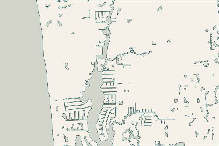
Get to know your waterfront
The East Naples Bay district covers canals in Golden Shores, Oyster Bay and Royal Harbor, from both sides of Curlew Avenue south. The City expressly excludes properties facing Naples Bay. The district dates to 1987 and addresses water quality, navigability and maintenance dredging. Those responsibilities should not be confused with a promise to repair a private seawall.
Look at the bottom as well as the cap
The East Naples Bay dredging notes describe rock and sand in the canal system. They also require post-dredge surveys for individual canals. If settlement, a leaning panel or a gap appears near the waterline, ask the assessor whether those records help explain the setting and what inspection of the wall toe is appropriate. Dredging material and scope Survey records
What the local files can establish
- The district’s boundary excludes direct Naples Bay frontage.
- The City’s Natural Resources Division administers the district with an advisory board.
- Project specifications address protection of oysters and native vegetation around shorelines and access areas.
- The FY 2023–24 report records storm-related dredging delays after Ian and Helene.
Use the last point as historical context, not a claim that your canal is unfinished. Ask for its latest completion and survey documents. District boundary Habitat protection notes Historical project report
For a bay-facing property, ask the designer how the actual exposure differs from a sheltered canal. For either setting, identify dock loads, neighboring returns and temporary access before comparing repair proposals.
What could the work cost?
Ask bidders to identify the survey, underwater inspection and access assumptions in their price. Rock removal, dock interference and restoration should have clear inclusions rather than a single unexplained allowance.
Published contractor context, not a Naples average or a quote.
Compare quotes and plan a budget →Find the relevant permits and records
| Starting point | What to resolve | Prepare and look up |
|---|---|---|
City of Naples Building | Confirm the parcel, marine work and required plan set. | Bring the address, survey and photos. Published permit help: (239) 213-5020. |
East Naples Bay district records | Confirm canal coverage and obtain relevant dredging documentation. | Give the canal name, street and waterfront orientation; ask for the latest survey for that location. |
Trace the public and private work
A district map and a private survey answer different questions. Keep both with the assessment photos.
Confirm canal or bay frontage
Locate the wall on the parcel survey and compare it with the district description. Get clarification if a corner property has different waterfront exposures.
Request the canal’s latest survey
Ask for the dated post-dredge or other bathymetric record for the exact canal. A report for the entire district may not describe your wall toe.
Define the construction boundaries
Mark vegetation, oysters, neighboring docks and staging space. Ask who will secure access and how temporary works will be removed and the site restored.
Plan your Royal Harbor project
Share the property address, the changes you have noticed and any photos or previous plans you have.
Clear options for your waterfront. A practical next step.
Royal Harbor project questions
Does the taxing district repair my seawall?
Its published purpose covers water quality, navigation and maintenance dredging. That does not establish responsibility for an individual wall. Confirm wall ownership and any recorded agreements separately, especially where a parcel faces Naples Bay rather than a district canal.
Does the old dredging plan set my wall’s required depth?
No. It describes a particular public dredging project. A private-wall designer needs the current site conditions, structural scope and applicable approvals. Do not treat the historical project’s dredging limits or survey datum as a universal seawall specification.
Keep planning
Nearby waterfront guides
Show sourcesHide sources
- East Naples Bay Special Taxing DistrictSource reviewed 2026-10-25 · official indexed text
- East Naples Bay Dredging general notesSource reviewed 2026-10-25 · official indexed text
- FY 2023-24 Public Works annual report excerptSource reviewed 2026-10-25 · official indexed text
- City electronic permit helpSource reviewed 2026-10-25 · official indexed text
- City seawall permit checklistSource reviewed 2026-11-05